Mount Gahinga is a dormant/extinct volcano in the Virunga Mountains on the border between Rwanda and Uganda. Gahinga lies between Muhabura and Sabyinyo, and is the smallest of these three. Mgahinga Gorilla National Park derives its name from this volcanic mountain where the word Gahinga comes from the local Kinyarwanda/Rufumbira dialect meaning “a small pile of stones”.
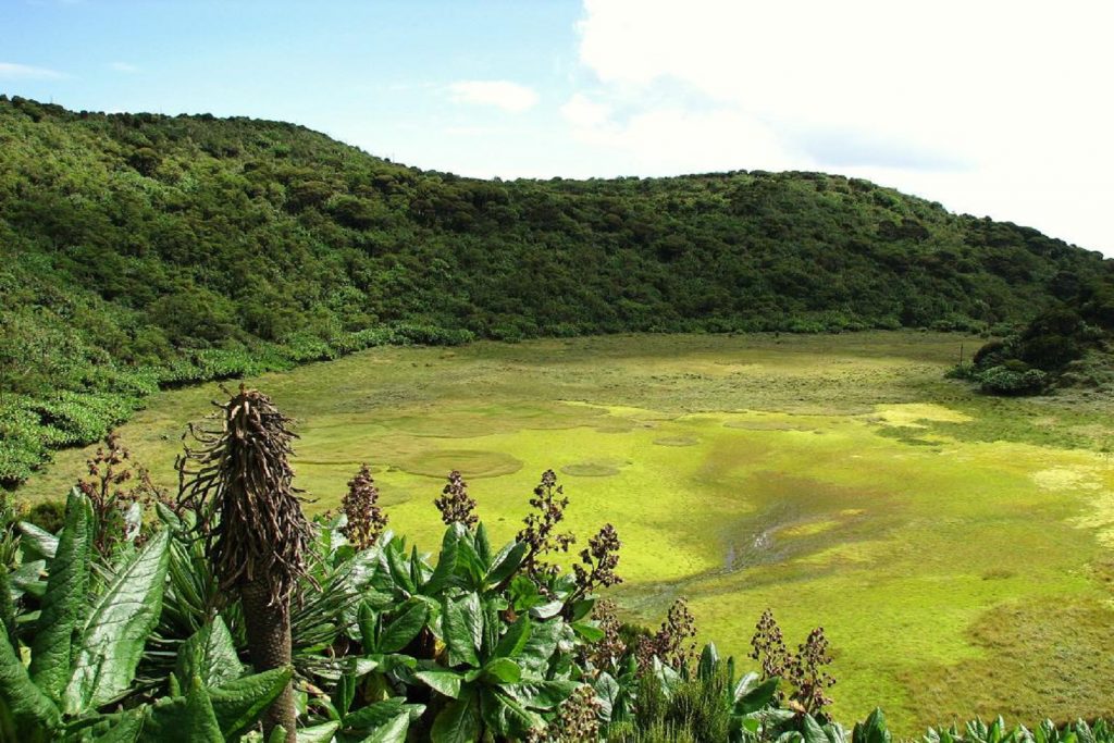
Mount Gahinga has a swampy caldera on its peak believed to be as wide as 180 meters wide. Mount Gahinga, whose elevation is 3,474 meters, is part of a chain of 8 volcanic mountains of the Mufumbiro ranges.
BOOK NOW
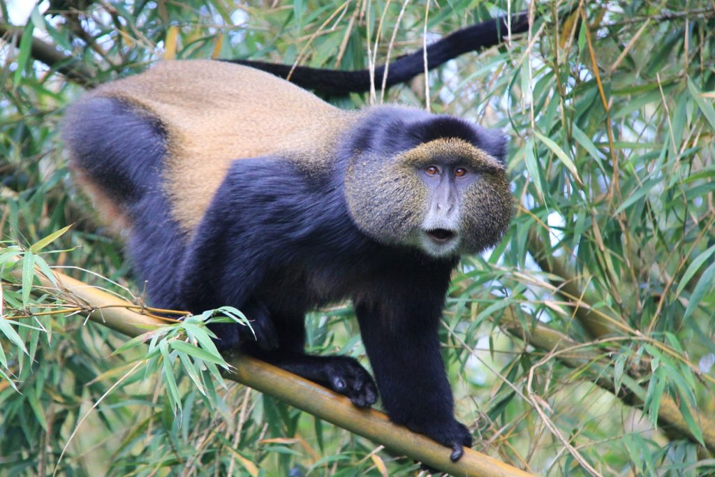
The volcano chain spans across Uganda, Rwanda and the Democratic Republic of Congo. Climbing Mt Mgahinga is a unique opportunity to see golden monkeys, wildlife and mountain gorillas which is around 3400m. The hiking trail leading to the summit crater has a pleasant climb and has several interesting features like its volcanic caves.
Encountering the golden monkeys
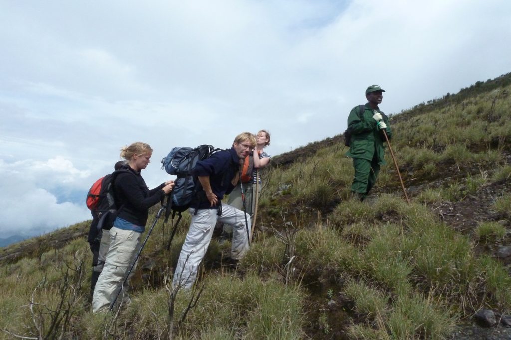
The climb takes you first through bamboo forest on the base before you climb the slopes of the volcano. As you continue hiking mountain Mgahinga you will be able to see a nearby bush shaking leaves as golden monkeys eat them for breakfast while jumping from one tree to another. Astonishing view of Mount Sabinyo and Mount Muhavura from a distance that hiking more eager to return to Kisoro at a later date to climb them as well.

Mt Mgahinga is recommended as a less technical 6-8 hour day hike that could easily be fitted in over a weekend which will spark your excitement inside you. You’ll encounter different types of vegetation with every ascent when you’re towards the summit of Mt Mgahinga, where the bamboo trees which are favorite part of the hike are set tall. These slender trees lined up against each other with hundreds of bird nests resting high up in the undisturbed branches, will give you an opportunity to listen to unique tweaks of bird and trees.
The climber will be given the park guide to trek from the park headquarters in Kinigi, from where hikers will have to drive or be driven to the base of the volcano and permits can be purchased on the day of the climb, no advance booking is necessary and porters can also be hired for the trek as you’re going to hike.
A views of the caldera at the mountain top
The crater of Mt Mgahinga is quite shallow and its floor is covered in swamps and moors where plants like Alchemillia, Senecio and Lobelia thrive. The environment on Mt Mgahinga is quite different from the other volcanoes in the national park. Depending on the strength of the climbers and the time spent at the summit, hiking up Mt Mgahinga will typically take you a half day where you will piece of nature that excites all the sense.
This provides a cool shade that makes hiking underneath it very mentally & physically relaxing. This occasionally halted at resting points for refreshments and take memorable million dollar pictures.

The view at the top is eye-catching where the peak of Gahinga is the central location of all the borders of Rwanda, Congo and Uganda. That explained the various “Welcome to Congo” and “Welcome to Rwanda” texts you will receive from Tigo and Airtel telecommunication providers on your phone! It is a bit confusing as if you are in three different countries at the same time – even the time zone change as you adopt the Rwandan time zone that is an hour behind Uganda’s.
Don’t miss to be glad to add Mount Mgahinga off your hiking conquest list and your eagerly waiting to go back and hike Mount Sabinyo and Mount Muhavura to successfully complete the peaks that make up the Virunga Mountains.
BOOK NOW
